QUESTION IMAGE
Question
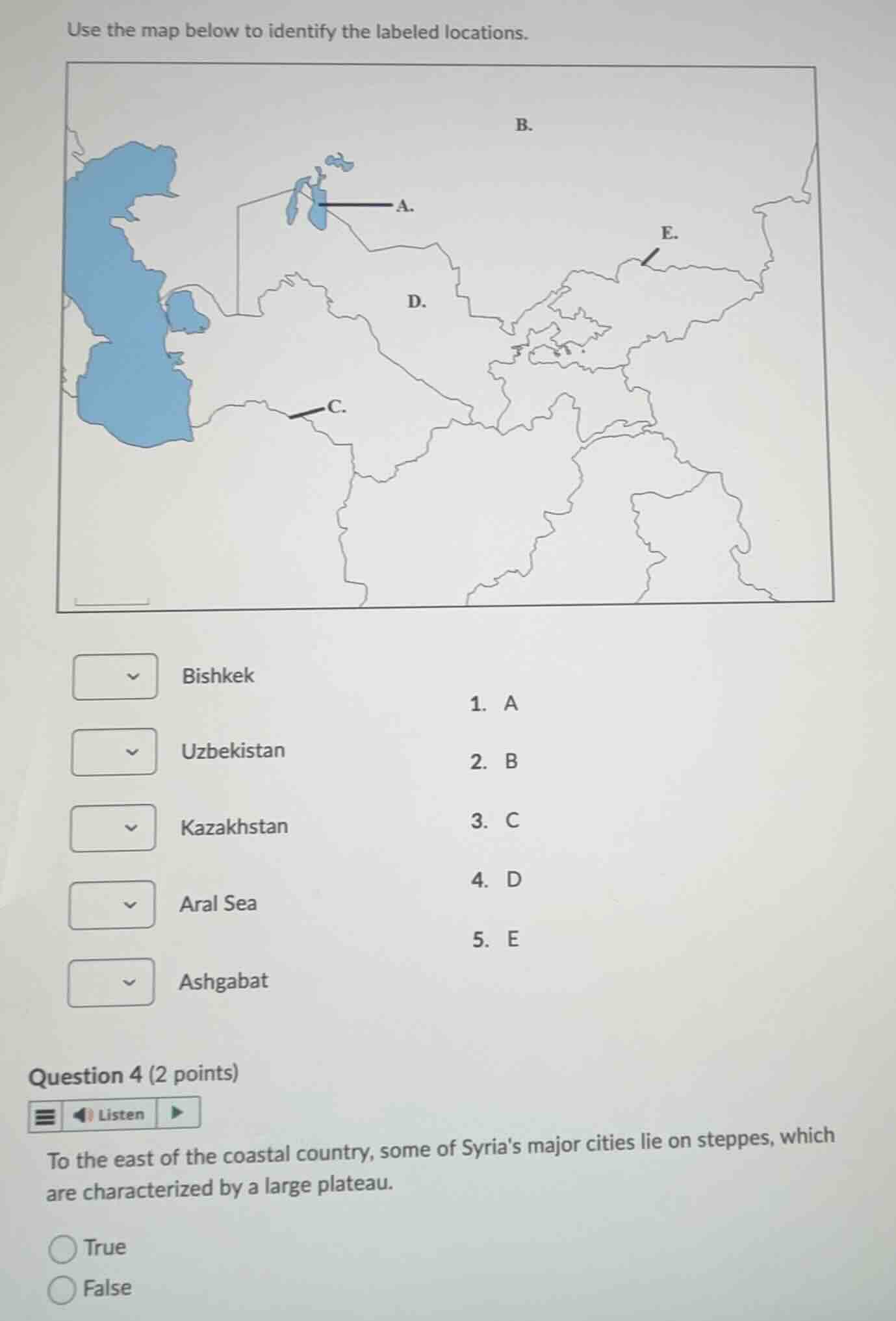
use the map below to identify the labeled locations.
bishkek
uzbekistan
kazakhstan
aral sea
ashgabat
- a
- b
- c
- d
- e
question 4 (2 points)
to the east of the coastal country, some of syrias major cities lie on steppes, which are characterized by a large plateau.
true
false
Identify the labeled locations on the Central Asia map
- A points to the Aral Sea, located between Kazakhstan and Uzbekistan.
- B points to Kazakhstan, the large country dominating the northern part of Central Asia.
- C points to Ashgabat, the capital city of Turkmenistan, located near the southern border.
- D points to Uzbekistan, located south of Kazakhstan.
- E points to Bishkek, the capital city of Kyrgyzstan, located in the eastern part of the region.
Matching these to the dropdown items:
- Bishkek: E (5)
- Uzbekistan: D (4)
- Kazakhstan: B (2)
- Aral Sea: A (1)
- Ashgabat: C (3)
Analyze the statement about Syria's geography
- The statement: "To the east of the coastal country, some of Syria's major cities lie on steppes, which are characterized by a large plateau."
- Syria's geography consists of a narrow coastal plain in the west, a mountainous region (coastal range), and a large semi-arid plateau (the Syrian Desert/steppe) to the east where major cities like Aleppo, Hama, and Damascus lie along the transition zone. This plateau/steppe region characterizes the eastern portion of the country.
- Therefore, the statement is True.

Snap & solve any problem in the app
Get step-by-step solutions on Sovi AI
Photo-based solutions with guided steps
Explore more problems and detailed explanations
Question 1: Map Matching
- Bishkek: E
- Uzbekistan: D
- Kazakhstan: B
- Aral Sea: A
- Ashgabat: C
Question 2: True/False
- True (Correct answer)
- False