QUESTION IMAGE
Question
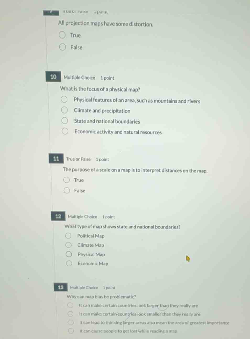
true or false 1 point
all projection maps have some distortion.
true
false
10 multiple choice 1 point
what is the focus of a physical map?
physical features of an area, such as mountains and rivers
climate and precipitation
state and national boundaries
economic activity and natural resources
11 true or false 1 point
the purpose of a scale on a map is to interpret distances on the map.
true
false
12 multiple choice 1 point
what type of map shows state and national boundaries?
political map
climate map
physical map
economic map
13 multiple choice 1 point
why can map bias be problematic?
it can make certain countries look larger than they really are
it can make certain countries look smaller than they really are
it can lead to thinking larger areas also mean the area of greatest importance
it can cause people to get lost while reading a map
Analyze map projection distortion
All map projections attempt to represent a 3D sphere on a 2D flat surface, which mathematically requires stretching or tearing, causing distortion in shape, area, distance, or direction.
- Question 9: True
Identify the focus of a physical map
Physical maps are designed to show the natural landscape features of Earth.
- Question 10: Physical features of an area, such as mountains and rivers
Determine the purpose of a map scale
A map scale represents the ratio between a distance on the map and the corresponding actual distance on the ground, allowing users to interpret real-world distances.
- Question 11: True
Identify the map showing boundaries
Political maps focus on governmental boundaries of countries, states, and counties, as well as the location of major cities and significant bodies of water.
- Question 12: Political Map
Analyze the problem of map bias
Map bias, such as the size distortion in the Mercator projection, can lead to misconceptions about the relative importance, power, or size of different regions.
- Question 13: It can lead to thinking larger areas also mean the area of greatest importance

Snap & solve any problem in the app
Get step-by-step solutions on Sovi AI
Photo-based solutions with guided steps
Explore more problems and detailed explanations
Question 9
- True (Correct answer)
- False
Question 10
- Physical features of an area, such as mountains and rivers (Correct answer)
- Climate and precipitation
- State and national boundaries
- Economic activity and natural resources
Question 11
- True (Correct answer)
- False
Question 12
- Political Map (Correct answer)
- Climate Map
- Physical Map
- Economic Map
Question 13
- It can make certain countries look larger than they really are
- It can make certain countries look smaller than they really are
- It can lead to thinking larger areas also mean the area of greatest importance (Correct answer)
- It can cause people to get lost while reading a map