QUESTION IMAGE
Question
select the correct location.
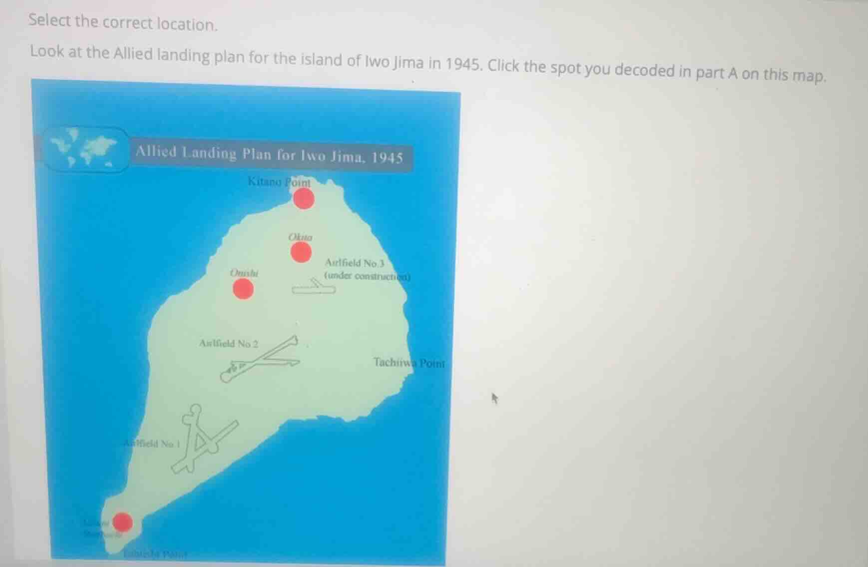
look at the allied landing plan for the island of iwo jima in 1945. click the spot you decoded in part a on this map.
Identify the historical context
The question asks us to locate a specific spot on the Allied landing plan map for Iwo Jima in 1945. The prompt mentions "the spot you decoded in part A". In standard historical curricula covering the Pacific Theater Battles, Part A of this activity typically involves decoding a message or identifying the primary landing zone or key geographical feature where the initial Allied assault took place. The primary landing beaches for the U.S. Marines on Iwo Jima were located on the southeastern coast, directly adjacent to Mount Suribachi.
Analyze the map locations
Let's evaluate the red interactive dots shown on the map:
- Kitano Point: Located at the northernmost tip of the island.
- Okita: Located in the north-central region, near Airfield No. 3.
- Onishi: Located in the western-central region.
- Mount Suribachi / Futatsu Rock (Southeastern Coast): Located at the southwestern tip of the island, near Airfield No. 1. The red dot is placed at the southern tip, which represents Mount Suribachi (labeled "Mount Suribachi" near the bottom left).
Determine the correct target
The Battle of Iwo Jima began on February 19, 1945, with the U.S. Marines landing on the southeastern beaches (the stretch of coast between Mount Suribachi at the southern tip and Tachiiwa Point to the east). The capture of Mount Suribachi, located at the southern tip of the island, was one of the most critical and famous objectives of the early landing phase (where the iconic flag-raising took place). The red dot at the southern tip next to Mount Suribachi represents this key landing and strategic objective area.
Formulate the final guidance
Explain the significance of Mount Suribachi and the southeastern landing beaches in the context of the Pacific Theater Battles to guide the student to the correct interactive spot on the map.

Snap & solve any problem in the app
Get step-by-step solutions on Sovi AI
Photo-based solutions with guided steps
Explore more problems and detailed explanations
The correct location to select on the map is the red dot at the southern tip of the island, labeled near Mount Suribachi (at the bottom-left corner of the island, near Airfield No. 1).
During the Allied landing on Iwo Jima in February 1945, the primary invasion beaches were located along the southeastern coast, immediately adjacent to Mount Suribachi, making this southern point the critical initial objective of the assault.