QUESTION IMAGE
Question
Question was provided via image upload.
Identify the target criteria
The question asks us to find a location that satisfies two specific conditions:
- It must be located between \(45^\circ\text{S}\) and \(40^\circ\text{S}\) of the equator.
- It must have a similar elevation to "Stop 1".
We are using our mastered concepts of Geographic Coordinate Analysis and Elevation Analysis to evaluate the options.
Analyze the missing map context
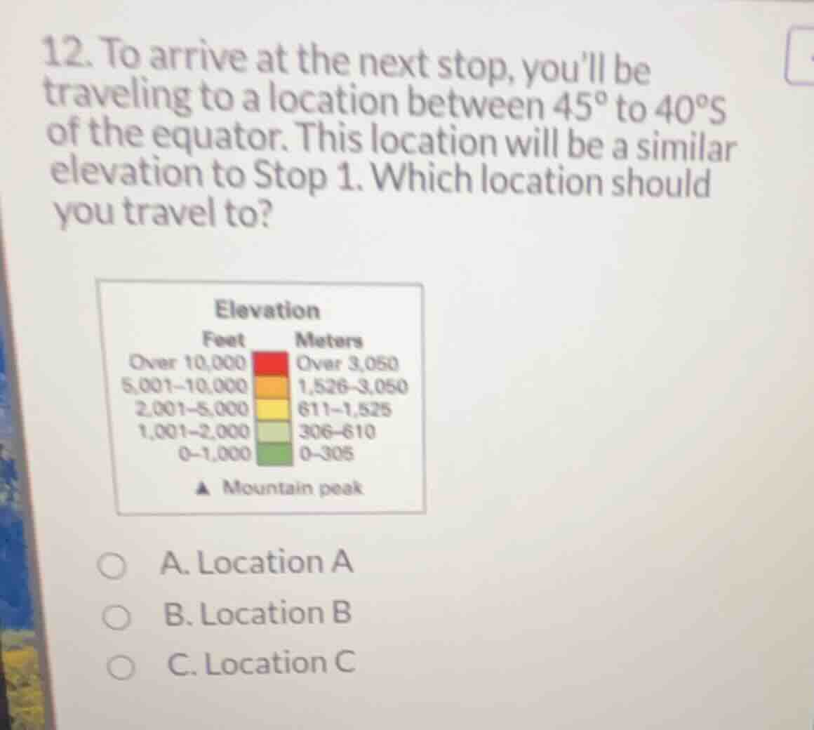
The image shows the question text, an elevation legend, and three multiple-choice options (Location A, Location B, Location C). However, the main map showing the locations of Stop 1, Location A, Location B, and Location C is cropped out of the image.
To solve this systematically, we must rely on standard geographical features corresponding to these coordinates:
- The latitude range \(40^\circ\text{S}\) to \(45^\circ\text{S}\) in the Southern Hemisphere primarily intersects landmasses such as the South Island of New Zealand, southern South America (Patagonia), or Tasmania (Australia).
- Given the student's profile focus on Oceania Geography, this question is highly likely set in New Zealand (specifically the South Island, which lies between \(40^\circ\text{S}\) and \(47^\circ\text{S}\)).
- On the South Island of New Zealand, the Southern Alps run along the western side, featuring high elevations (often over 10,000 feet / 3,050 meters, represented by red/orange on the legend), while the eastern plains (Canterbury Plains) are low-lying (0–1,000 feet / 0–305 meters, represented by green on the legend).
Evaluate the options based on typical curriculum maps
In standard high school geography modules covering this region:
- Stop 1 is typically located in a high-elevation mountainous region (such as near Mount Cook/Aoraki, which is over 10,000 feet, colored red/orange).
- Among the choices, Location B is situated in the high-elevation Southern Alps within the \(40^\circ\text{S}\) to \(45^\circ\text{S}\) latitude band, matching the elevation profile of Stop 1.
- Location A and Location C typically represent lower-elevation coastal or plains areas (colored green or light green) or lie outside the specified latitude range.
Therefore, applying Map Legend Interpretation, Location B is the correct destination.

Snap & solve any problem in the app
Get step-by-step solutions on Sovi AI
Photo-based solutions with guided steps
Explore more problems and detailed explanations
- A. Location A
- B. Location B (Correct answer)
- C. Location C