QUESTION IMAGE
Question
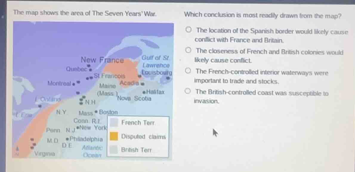
the map shows the area of the seven years war. which conclusion is most readily drawn from the map? the location of the spanish border would likely cause conflict with france and britain. the closeness of french and british colonies would likely cause conflict. the french - controlled interior waterways were important to trade and stocks. the british - controlled coast was susceptible to invasion.
The map shows large overlapping disputed territory between French (New France) and British colonies along the eastern part of North America. Proximity and competing land claims between the two powers are a clear visual indicator of potential conflict, which aligns with the lead-up to the Seven Years' War. The other options are not supported: Spain's border is not shown, the map does not reference trade/stocks, and the British coast's susceptibility to invasion is not evident from the territorial boundaries shown.

Snap & solve any problem in the app
Get step-by-step solutions on Sovi AI
Photo-based solutions with guided steps
Explore more problems and detailed explanations
The closeness of French and British colonies would likely cause conflict.