QUESTION IMAGE
Question
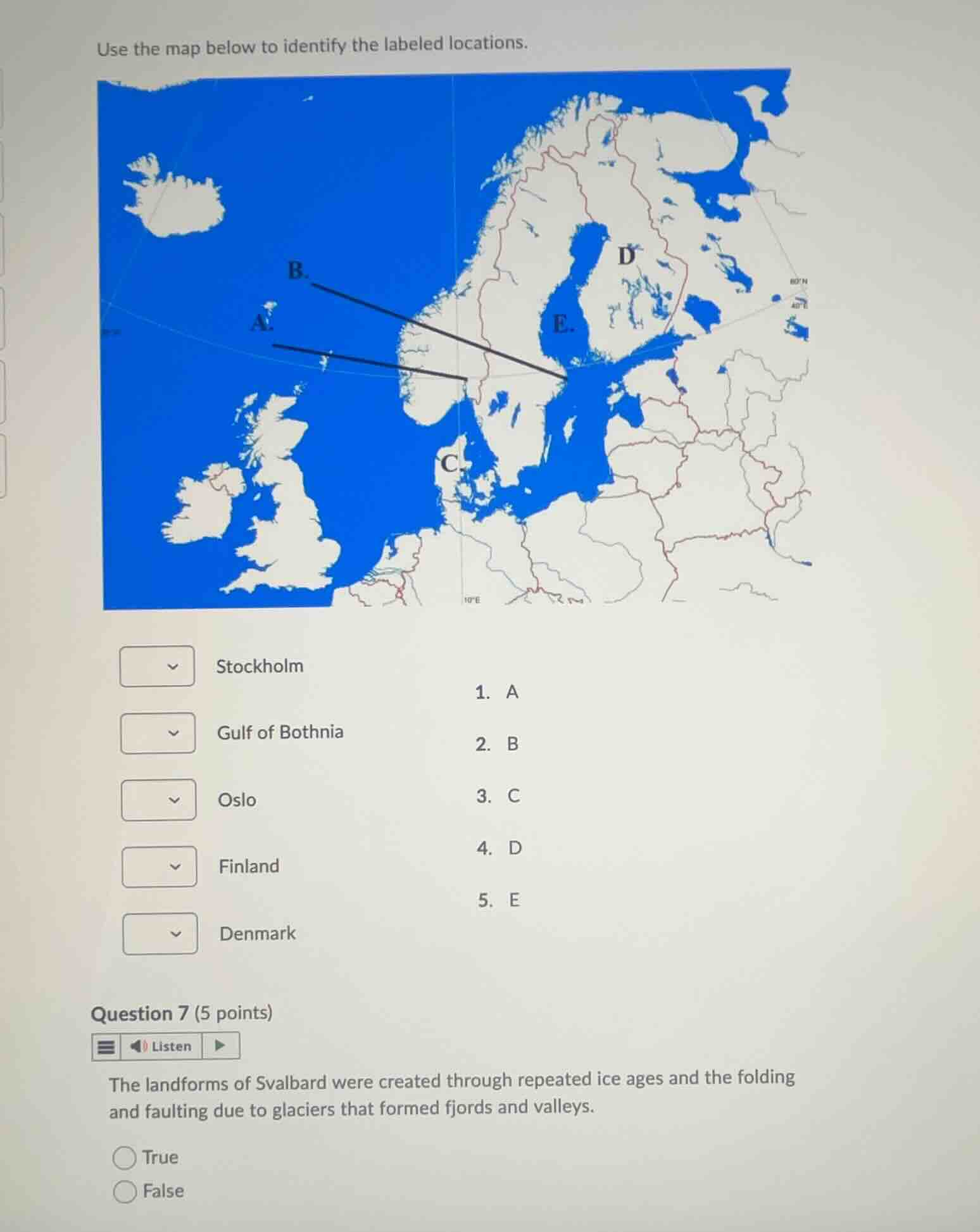
use the map below to identify the labeled locations.
stockholm
- a
gulf of bothnia
- b
oslo
- c
finland
- d
denmark
- e
question 7 (5 points)
the landforms of svalbard were created through repeated ice ages and the folding and faulting due to glaciers that formed fjords and valleys.
true
false
Identify the map labels A, B, C, D, and E
- Label A points to Oslo, the capital of Norway.
- Label B points to Stockholm, the capital of Sweden.
- Label C points to Denmark.
- Label D points to Finland.
- Label E points to the Gulf of Bothnia.
Analyze the statement in Question 7
- Svalbard's landforms were heavily shaped by repeated ice ages, glaciation, and tectonic activity (folding and faulting), which carved out its characteristic fjords and valleys.
- Therefore, the statement is true.

Snap & solve any problem in the app
Get step-by-step solutions on Sovi AI
Photo-based solutions with guided steps
Explore more problems and detailed explanations
Question 1
- Stockholm: B (2)
- Gulf of Bothnia: E (5)
- Oslo: A (1)
- Finland: D (4)
- Denmark: C (3)
Question 2
- True (Correct answer)
- False