QUESTION IMAGE
Question
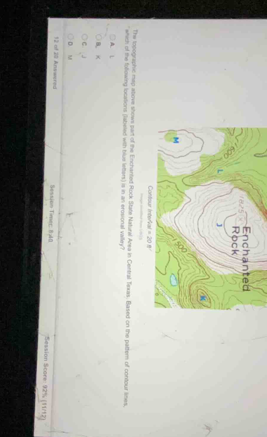
the topographic map above shows part of the enchanted rock state natural area in central texas. based on the pattern of contour lines, which of the following locations (labeled with blue letters) is in an erosional valley?
a. l
b. k
c. j
d. m
Analyze the topographic features
To identify which lettered location is in an erosional valley, we must analyze the contour line patterns at each point:
- J is located near the summit of Enchanted Rock (elevation peak marked at 1825 ft), which represents a high dome or hilltop.
- M is located at the center of concentric closed contours, representing another hill or summit peak.
- K is located on a relatively uniform slope or ridge side.
- L is situated in a low area between the high dome of Enchanted Rock and the hill to the northwest. The contour lines around L form a "V" shape pointing uphill (towards higher elevation), which is the classic topographic signature of a valley or stream channel carved by erosion.
Apply the V-shaped contour rule
In topographic mapping, when contour lines cross a valley or stream channel, they bend into a "V" shape that points upstream (uphill towards higher elevation). Point L lies directly in this drainage path between the elevated landforms, indicating it is located in an erosional valley.

Snap & solve any problem in the app
Get step-by-step solutions on Sovi AI
Photo-based solutions with guided steps
Explore more problems and detailed explanations
- (A) L (Correct answer)
- (B) K
- (C) J
- (D) M