QUESTION IMAGE
Question
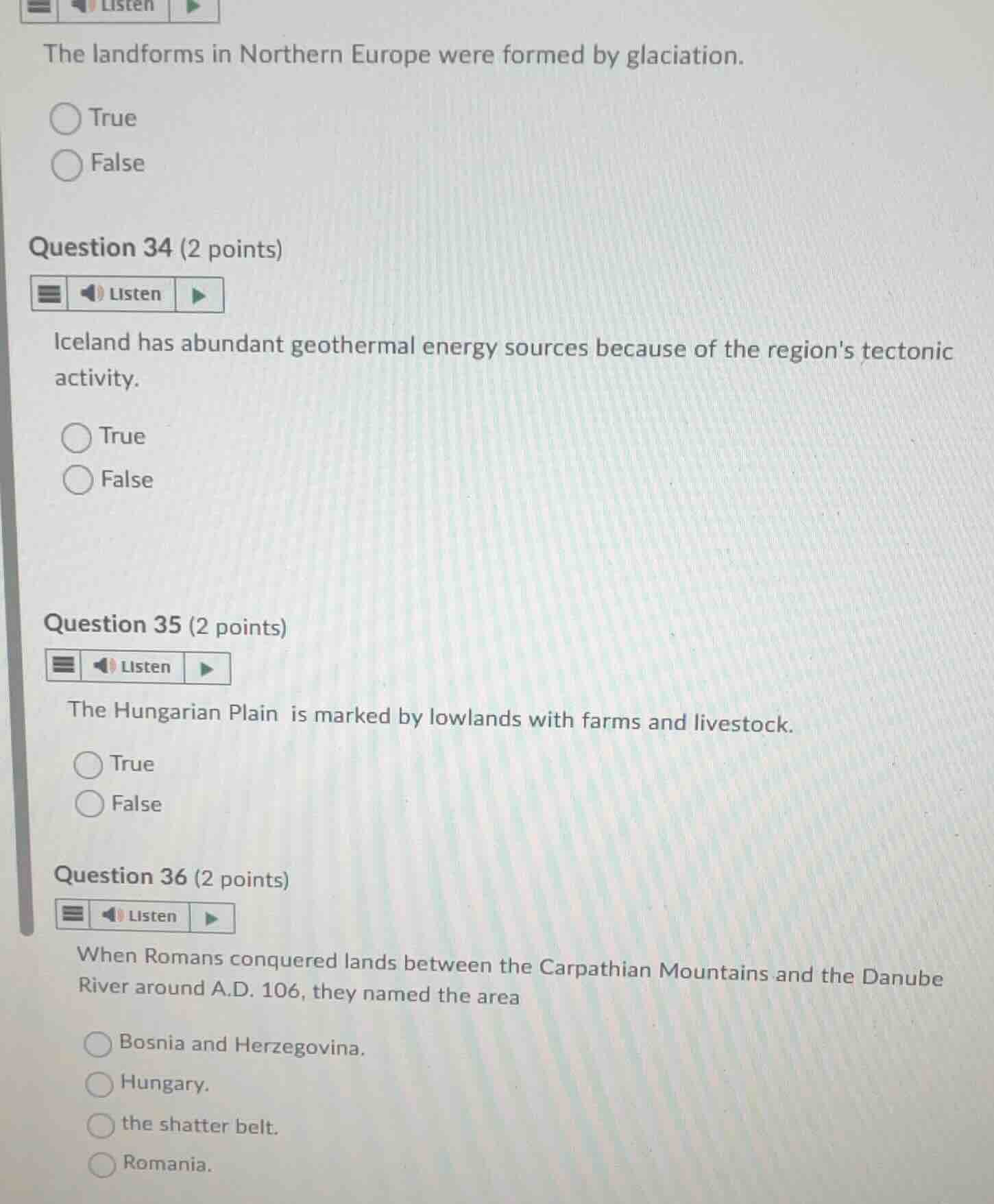
the landforms in northern europe were formed by glaciation.
true
false
question 34 (2 points)
iceland has abundant geothermal energy sources because of the regions tectonic activity.
true
false
question 35 (2 points)
the hungarian plain is marked by lowlands with farms and livestock.
true
false
question 36 (2 points)
when romans conquered lands between the carpathian mountains and the danube river around a.d. 106, they named the area
bosnia and herzegovina.
hungary.
the shatter belt.
romania.
Analyze the glaciation statement
The landforms in Northern Europe (such as fjords, lakes, and moraines) were heavily shaped and formed by glaciation during the last Ice Age. Therefore, the statement is true.
Analyze the Iceland geothermal statement
Iceland is situated on the Mid-Atlantic Ridge, a divergent tectonic plate boundary, which causes high volcanic and tectonic activity. This tectonic activity provides abundant geothermal energy sources. Therefore, the statement is true.
Analyze the Hungarian Plain statement
The Hungarian Plain (Great Hungarian Plain) is a flat, lowland region characterized by fertile soils, which makes it highly suitable for agriculture (farms) and livestock raising. Therefore, the statement is true.
Analyze the Roman conquest statement
In A.D. 106, the Roman Emperor Trajan conquered the region between the Carpathian Mountains and the Danube River. The Romans named this province Dacia, which corresponds closely to modern-day Romania.

Snap & solve any problem in the app
Get step-by-step solutions on Sovi AI
Photo-based solutions with guided steps
Explore more problems and detailed explanations
Question 33
- True (Correct answer)
- False
Question 34
- True (Correct answer)
- False
Question 35
- True (Correct answer)
- False
Question 36
- Bosnia and Herzegovina.
- Hungary.
- the shatter belt.
- Romania. (Correct answer)