QUESTION IMAGE
Question
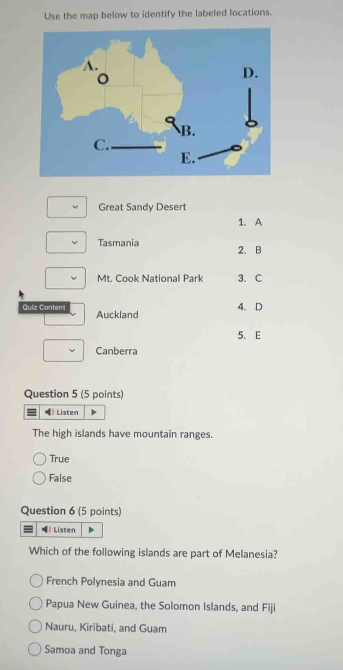
use the map below to identify the labeled locations.
great sandy desert
tasmania
mt. cook national park
auckland
canberra
- a
- b
- c
- d
- e
question 5 (5 points)
the high islands have mountain ranges.
true
false
question 6 (5 points)
which of the following islands are part of melanesia?
french polynesia and guam
papua new guinea, the solomon islands, and fiji
nauru, kiribati, and guam
samoa and tonga
Match map labels to geographic locations
- A points to northwestern Australia, corresponding to the Great Sandy Desert.
- B points to the capital territory of Australia, corresponding to Canberra.
- C points to the island state south of the Australian mainland, corresponding to Tasmania.
- D points to the northern region of New Zealand's North Island, corresponding to Auckland.
- E points to the Southern Alps region of New Zealand's South Island, corresponding to Mt. Cook National Park.
Evaluate high island topography
- High islands in the Pacific are of volcanic origin and characteristically feature rugged mountain ranges.
Identify Melanesian islands
- Melanesia includes Papua New Guinea, the Solomon Islands, Fiji, Vanuatu, and New Caledonia.
- French Polynesia and Samoa are part of Polynesia; Guam, Nauru, and Kiribati are part of Micronesia.

Snap & solve any problem in the app
Get step-by-step solutions on Sovi AI
Photo-based solutions with guided steps
Explore more problems and detailed explanations
Question 1
- Great Sandy Desert: A
- Tasmania: C
- Mt. Cook National Park: E
- Auckland: D
- Canberra: B
Question 5
- True (Correct answer)
- False
Question 6
- French Polynesia and Guam
- Papua New Guinea, the Solomon Islands, and Fiji (Correct answer)
- Nauru, Kiribati, and Guam
- Samoa and Tonga