QUESTION IMAGE
Question
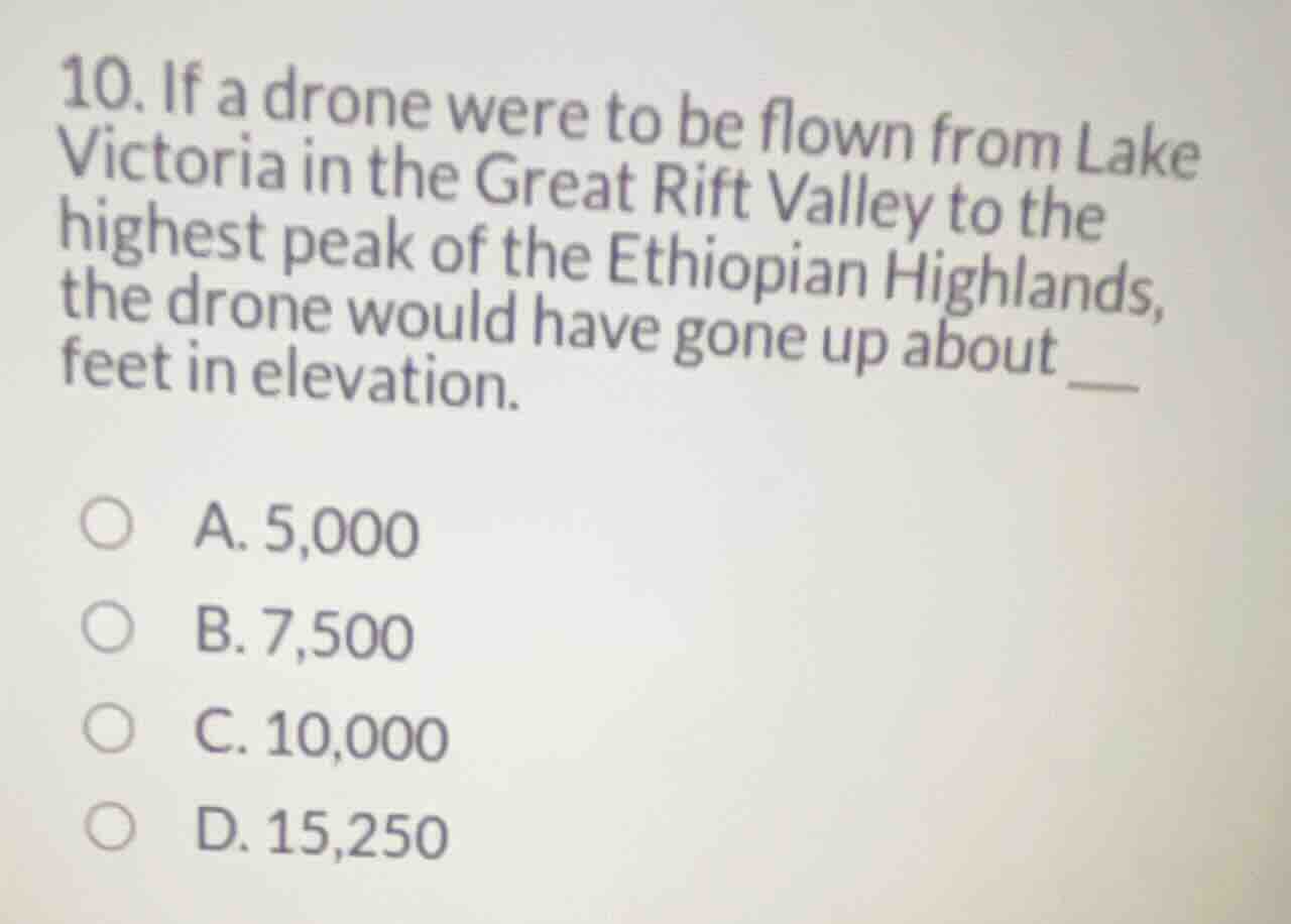
- if a drone were to be flown from lake victoria in the great rift valley to the highest peak of the ethiopian highlands, the drone would have gone up about ___ feet in elevation.
a. 5,000
b. 7,500
c. 10,000
d. 15,250
Identify the starting elevation
We apply our knowledge of African Geography and African Topography to find the elevation of Lake Victoria. Lake Victoria lies at an elevation of approximately \(3,724\text{ feet}\) (\(1,135\text{ meters}\)) above sea level.
Identify the destination elevation
Next, we identify the highest peak of the Ethiopian Highlands, which is Ras Dashen. Ras Dashen has an elevation of approximately \(14,928\text{ feet}\) (\(4,550\text{ meters}\)) above sea level.
Calculate the elevation difference
We calculate the change in elevation by subtracting the starting elevation from the destination elevation:
Compare with options
The calculated change of \(11,204\text{ feet}\) is closest to \(10,000\text{ feet}\) among the given choices:
- A. 5,000
- B. 7,500
- C. 10,000
- D. 15,250
Thus, the drone would have gone up about \(10,000\text{ feet}\) in elevation.

Snap & solve any problem in the app
Get step-by-step solutions on Sovi AI
Photo-based solutions with guided steps
Explore more problems and detailed explanations
- (A) 5,000
- (B) 7,500
- (C) 10,000 (Correct answer)
- (D) 15,250