QUESTION IMAGE
Question
what does this sign show you?
what the weather is like
where the restaurants are
which way to go
what the speed limit is
🆕 New Concept Discovered: Reading and Interpreting Road Signs
Understanding visual cues and directions on public signage.
Step 1: Analyze the image content
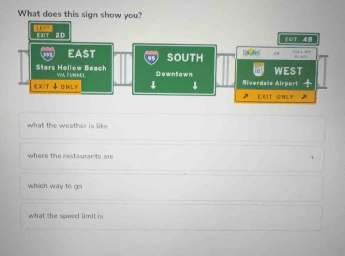
The image shows green highway overhead signs. These signs display:
- Route numbers (e.g., 395, 95, 112)
- Cardinal directions (EAST, SOUTH, WEST)
- Destinations (Stars Hollow Beach, Downtown, Riverdale Airport)
- Lane indicators and exit instructions (arrows, "EXIT ONLY", exit numbers)
Step 2: Evaluate the given options
- what the weather is like: Incorrect. There is no meteorological information (such as temperature or rain warnings) on these signs.
- where the restaurants are: Incorrect. These are highway guide signs, not service signs showing food locations.
- which way to go: Correct. The destinations, highway directions, and arrows tell drivers which lanes to take to reach their desired locations.
- what the speed limit is: Incorrect. Speed limit signs are regulatory black-and-white signs, which are not shown here.

Snap & solve any problem in the app
Get step-by-step solutions on Sovi AI
Photo-based solutions with guided steps
Explore more problems and detailed explanations
which way to go