QUESTION IMAGE
Question
contexts and problems
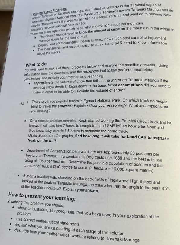
mount taranaki or taranaki maunga, is an inactive volcano in the taranaki region of aotearoa. egmont national park (te papakura o taranaki) covers taranaki maunga and its slopes. the park was first created in 1881 as a forest reserve and went on to become new zealands second national park in 1900.
there are a few agencies which need vital information about the mountain.
- the district council need to know the amount of snow on the mountain in the winter to manage rivers for the spring melt.
- department of conservation needs to know how much pest control to implement.
- the local search and rescue team, taranaki land sar need to know information about the tracks.
what to do:
you will need to pick 3 of these problems below and explore the possible answers. using information from the questions and the resources that follow perform appropriate calculations and explain your method and reasoning.
- approximate the volume of snow that falls in the winter on taranaki maunga if the average snow depth is \\(12\text{cm}\\) down to the base. what assumptions did you need to make in order to be able to calculate the volume of snow?
- there are three popular tracks in egmont national park. on which track do people tend to travel the slowest? explain / show your reasoning? what assumptions are you making?
- on a rescue practice exercise, noah started walking the pouakai circuit track and he knows it will take him \\(7\\) hours to complete. land sar left an hour after noah and they know they can do it \\(5\\) hours to complete the same track.
using algebra and/or graphs, find how long it will take for land sar to overtake noah on the walk.
- department of conservation believes there are approximately \\(20\\) possums per hectare on taranaki. to combat this doc could use \\(1080\\) and the best is to use \\(20\text{kg}\\) of \\(1080\\) per hectare. determine the possible population of possum and the amount of \\(1080\\) if doc decide to use it. (\\(1\text{ hectare} = 10,000\text{ square metres}\\))
- a maths teacher was standing on the back fields of inglewood high school and looked at the peak of taranaki maunga, he estimates that the angle to the peak is \\(9^{\circ}\\), is the teacher accurate? explain your answer.
how to present your learning:
in solving this problem you should:
- show calculations, as appropriate, that you have used in your exploration of the problem
- use correct mathematical statements
- explain what you are calculating at each stage of the solution
- describe how your mathematical working relates to taranaki maunga
⚡ Using what you learned: Creating Equations to Model Relationships
Step 1: Define variables and rates
Let the total distance of the Pouakai Circuit track be \( d \).
Noah's speed (\( v_N \)):
Land SAR's speed (\( v_S \)):
Let \( t \) be the time in hours since Noah started walking.
Since Land SAR starts 1 hour after Noah, their travel time is \( t - 1 \) (where \( t \ge 1 \)).
Step 2: Set up the distance equations
Noah's distance (\( d_N \)) as a function of \( t \):
Land SAR's distance (\( d_S \)) as a function of \( t \):
Step 3: Solve for the meeting time
Land SAR overtakes Noah when their distances are equal (\( d_S = d_N \)):
Divide both sides by \( d \):
Cross-multiply to solve for \( t \):
Step 4: Calculate time relative to Land SAR's departure
The question asks how long it will take for Land SAR to overtake Noah. This is measured from the time Land SAR starts walking:

Snap & solve any problem in the app
Get step-by-step solutions on Sovi AI
Photo-based solutions with guided steps
Explore more problems and detailed explanations
It will take Land SAR 2.5 hours (or 2 hours and 30 minutes) to overtake Noah.