QUESTION IMAGE
Question
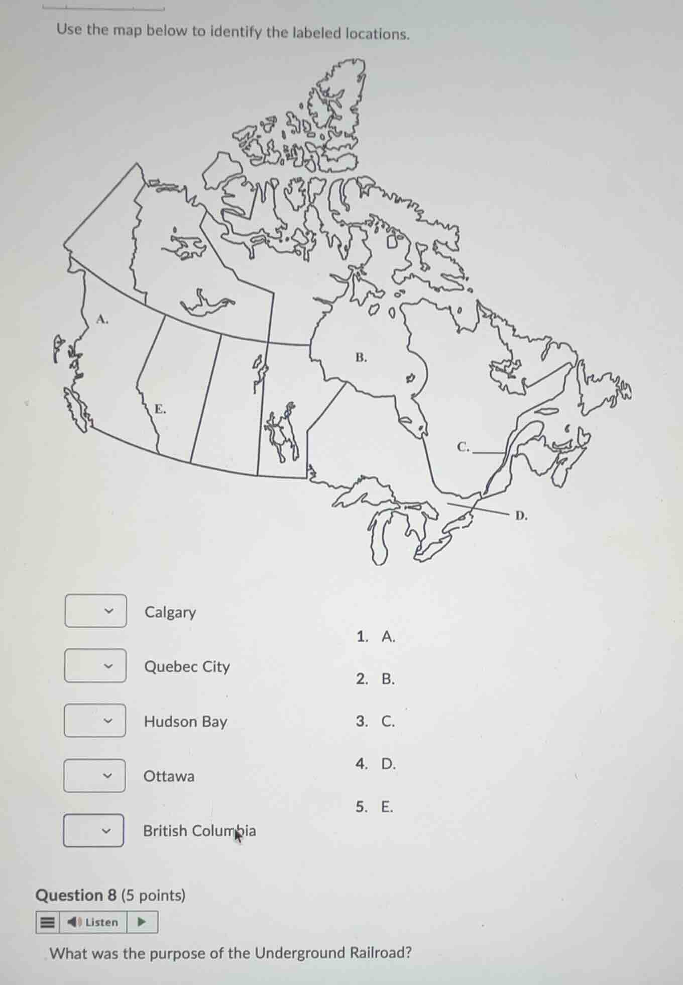
use the map below to identify the labeled locations.
calgary
quebec city
hudson bay
ottawa
british columbia
- a.
- b.
- c.
- d.
- e.
question 8 (5 points)
what was the purpose of the underground railroad?
Identify the labeled locations on the map of Canada
- A points to the westernmost province of Canada: British Columbia.
- B points to the large body of water in northeastern Canada: Hudson Bay.
- C points to the capital of the province of Quebec, located along the St. Lawrence River: Quebec City.
- D points to the national capital of Canada, located in southeastern Ontario: Ottawa.
- E points to the province of Alberta, where the major city of Calgary is located.
Determine the purpose of the Underground Railroad
- The Underground Railroad was a secret network of routes and safe houses established in the United States during the early-to-mid 19th century.
- Its primary purpose was to help enslaved African Americans escape from the Southern United States to free states in the North or to Canada, where slavery was prohibited.

Snap & solve any problem in the app
Get step-by-step solutions on Sovi AI
Photo-based solutions with guided steps
Explore more problems and detailed explanations
Question 1
- Calgary: E.
- Quebec City: C.
- Hudson Bay: B.
- Ottawa: D.
- British Columbia: A.
Question 2
The purpose of the Underground Railroad was to help enslaved African Americans escape from the Southern United States to freedom in the Northern free states and Canada.