QUESTION IMAGE
Question
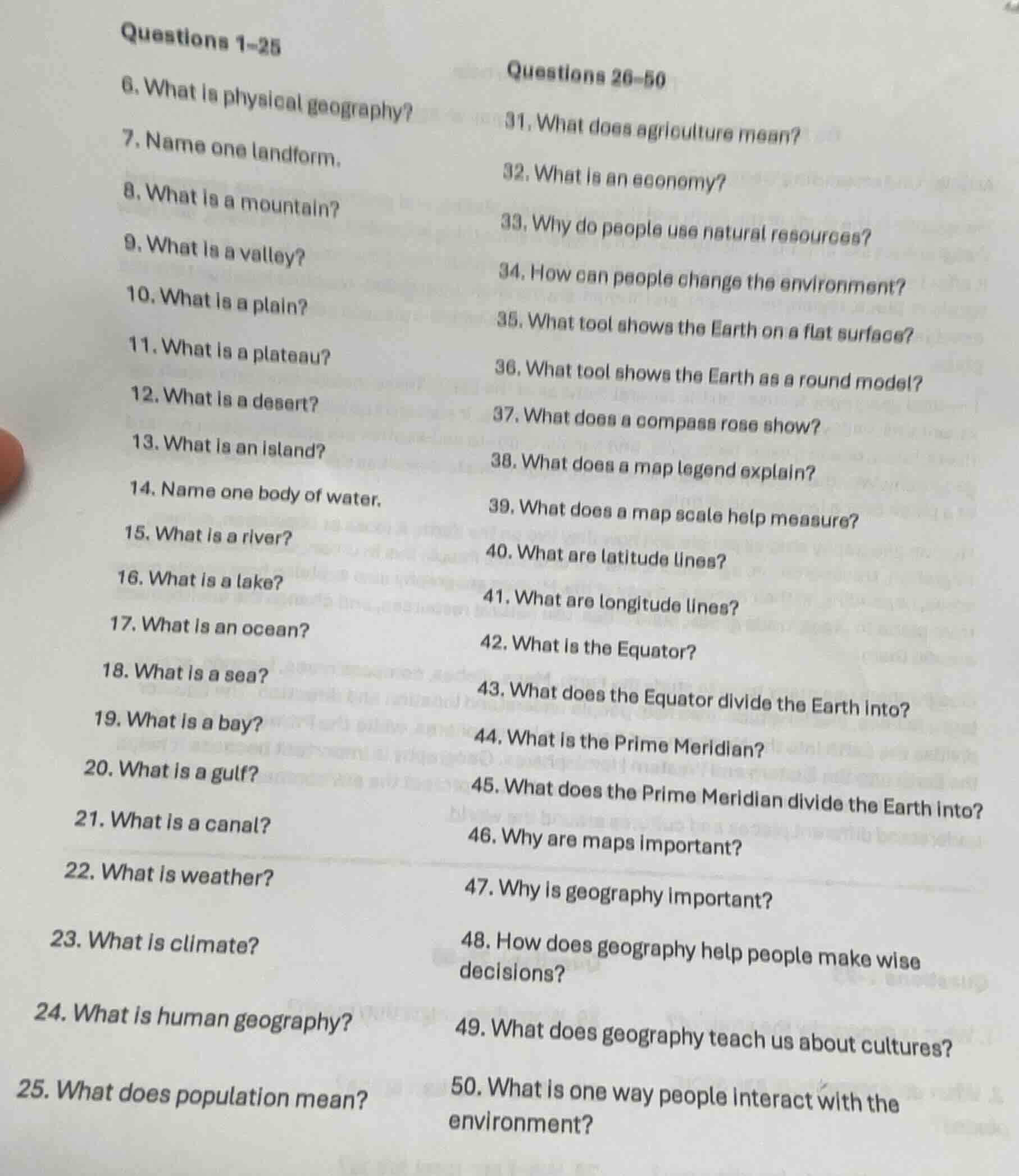
questions 1-25
- what is physical geography?
- name one landform.
- what is a mountain?
- what is a valley?
- what is a plain?
- what is a plateau?
- what is a desert?
- what is an island?
- name one body of water.
- what is a river?
- what is a lake?
- what is an ocean?
- what is a sea?
- what is a bay?
- what is a gulf?
- what is a canal?
- what is weather?
- what is climate?
- what is human geography?
- what does population mean?
questions 26-50
- what does agriculture mean?
- what is an economy?
- why do people use natural resources?
- how can people change the environment?
- what tool shows the earth on a flat surface?
- what tool shows the earth as a round model?
- what does a compass rose show?
- what does a map legend explain?
- what does a map scale help measure?
- what are latitude lines?
- what are longitude lines?
- what is the equator?
- what does the equator divide the earth into?
- what is the prime meridian?
- what does the prime meridian divide the earth into?
- why are maps important?
- why is geography important?
- how does geography help people make wise decisions?
- what does geography teach us about cultures?
- what is one way people interact with the environment?
Analyze the worksheet structure
The image contains a list of basic geography study questions numbered 6 through 50, split into two columns: "Questions 1–25" (showing 6–25) and "Questions 26–50" (showing 31–50). Because there are many questions with long stems, we will provide a concise, direct list of answers for each visible question.
Formulate concise answers for Column 1 (Questions 6–25)
- 6. Physical geography: Study of Earth's natural features and processes.
- 7. Landform: Mountain (or hill, plateau, valley).
- 8. Mountain: A very tall, steep natural landform rising high above its surroundings.
- 9. Valley: Low area of land between hills or mountains, often with a river.
- 10. Plain: A large area of flat land with few trees.
- 11. Plateau: A flat, elevated landform that rises sharply above surrounding area.
- 12. Desert: A dry, barren area of land with very little precipitation.
- 13. Island: A piece of land completely surrounded by water.
- 14. Body of water: Ocean (or river, lake).
- 15. River: A natural flowing stream of water heading towards another body of water.
- 16. Lake: A large body of water surrounded by land.
- 17. Ocean: A continuous body of saltwater covering most of the Earth.
- 18. Sea: A large body of saltwater smaller than an ocean, often partly surrounded by land.
- 19. Bay: A broad inlet of the sea where the land curves inward.
- 20. Gulf: A deep inlet of the sea almost surrounded by land, with a narrow mouth.
- 21. Canal: An artificial waterway constructed to allow the passage of boats or to carry water.
- 22. Weather: The state of the atmosphere at a specific place and time (e.g., heat, dryness, rain).
- 23. Climate: The long-term average weather conditions of a region over many years.
- 24. Human geography: Study of how human activity affects and is affected by the Earth.
- 25. Population: The total number of people living in a specific area.
Formulate concise answers for Column 2 (Questions 31–50)
- 31. Agriculture: The practice of farming, including cultivation of the soil and rearing of animals.
- 32. Economy: The system of how money, goods, and services are produced, sold, and bought.
- 33. Why use natural resources: To survive, make products, and generate energy.
- 34. How people change environment: By building cities, cutting down forests, or farming.
- 35. Tool showing Earth flat: A map.
- 36. Tool showing Earth round: A globe.
- 37. Compass rose: Shows cardinal directions (North, South, East, West) on a map.
- 38. Map legend: Explains the meaning of symbols, colors, and lines used on a map.
- 39. Map scale: Helps measure the real-world distance between two points on a map.
- 40. Latitude lines: Imaginary horizontal lines that measure distance north or south of the Equator.
- 41. Longitude lines: Imaginary vertical lines that measure distance east or west of the Prime Meridian.
- 42. Equator: The imaginary line of latitude that circles the Earth halfway between the North and South Poles.
- 43. Equator divides Earth into: Northern and Southern Hemispheres.
- 44. Prime Meridian: The imaginary line of longitude designated as 0 degrees.
- 45. Prime Meridian divides Earth into:…

Snap & solve any problem in the app
Get step-by-step solutions on Sovi AI
Photo-based solutions with guided steps
Explore more problems and detailed explanations
- Physical geography: The study of the Earth's natural features, climates, and physical processes.
- Landform: Mountain (or hill, plateau, valley, plain).
- Mountain: A landform that rises steeply high above its surrounding area, usually with a peak.
- Valley: A low area of land between hills or mountains, typically containing a river or stream.
- Plain: A large, flat area of land with few trees.
- Plateau: A flat, elevated landform that rises sharply above the surrounding area on at least one side.
- Desert: A dry, barren region that receives extremely low amounts of precipitation.
- Island: A piece of land completely surrounded by water.
- Body of water: Ocean (or river, lake, sea).
- River: A natural flowing stream of water, usually freshwater, flowing towards an ocean, sea, lake, or another river.
- Lake: A large body of water surrounded by land.
- Ocean: A vast body of saltwater that covers almost three-quarters of the Earth's surface.
- Sea: A large body of saltwater that is smaller than an ocean and often partially enclosed by land.
- Bay: A broad inlet of the sea where the land curves inward.
- Gulf: A large area of ocean or sea partly enclosed by land, with a narrow mouth.
- Canal: An artificial waterway built for navigation, irrigation, or drainage.
- Weather: The day-to-day conditions of the atmosphere at a specific time and place (e.g., temperature, rain, wind).
- Climate: The long-term average weather patterns of a specific region over a long period (usually 30+ years).
- Human geography: The study of human activities, cultures, communities, and their interactions with the environment.
- Population: The total number of people living in a specific geographic area.
- Agriculture: The practice of farming, including cultivating soil, growing crops, and raising livestock.
- Economy: The system of how goods, services, and resources are produced, distributed, and consumed in a society.
- Why people use natural resources: To meet basic survival needs (food, water, shelter) and to produce energy, goods, and technology.
- How people change the environment: By building cities, clearing forests for agriculture, constructing dams, and mining.
- Tool showing Earth flat: A map.
- Tool showing Earth as a round model: A globe.
- Compass rose: A symbol on a map that shows the cardinal directions (North, South, East, West).
- Map legend: A key that explains what the symbols, colors, and lines on a map represent.
- Map scale: A tool that shows the relationship between distances on the map and actual distances on the Earth's surface.
- Latitude lines: Imaginary horizontal lines (parallels) that measure distance north or south of the Equator.
- Longitude lines: Imaginary vertical lines (meridians) that measure distance east or west of the Prime Meridian.
- Equator: The imaginary line of latitude at \(0^\circ\) that circles the Earth halfway between the North and South Poles.
- Equator divides Earth into: The Northern Hemisphere and the Southern Hemisphere.
- Prime Meridian: The imaginary line of longitude at \(0^\circ\) that runs from the North Pole to the South Pole through Greenwich, England.
- Prime Meridian divides Earth into: The Eastern Hemisphere and the Western Hemisphere.
- Why maps are important: They help people navigate, locate places, understand spatial relationships, and analyze geographic data.
- Why geography is important: It helps us understand how human societies and natural environments interact and shape our world.
- How geography helps people make wise decisions: It provides spatial data to plan cities, manage natural resources, prepare for natural disasters, and protect ecosystems.
- What geography teaches us about cultures: It shows how different environments influence human traditions, clothing, food, shelter, and ways of life.
- One way people interact with the environment: Modifying the land (e.g., building terraces for farming) or adapting to it (e.g., wearing heavy coats in cold climates).